0.2 Miles, 50 Gain
I usually like to do a longer trip over the Thanksgiving holiday, but the weather over the weekend didn’t look good. The first big storm of the season was scheduled to hit Saturday, lasting into the next week. The weather on Friday still looked good however, so I made plans for a day trip to the Point Reyes area. The longest hike would be out to Tomales Point, with a few shorter hikes mixed in to round out the day.
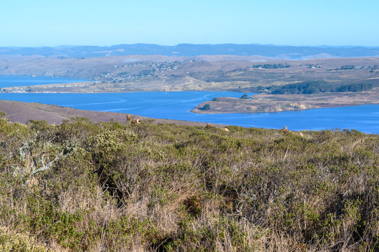
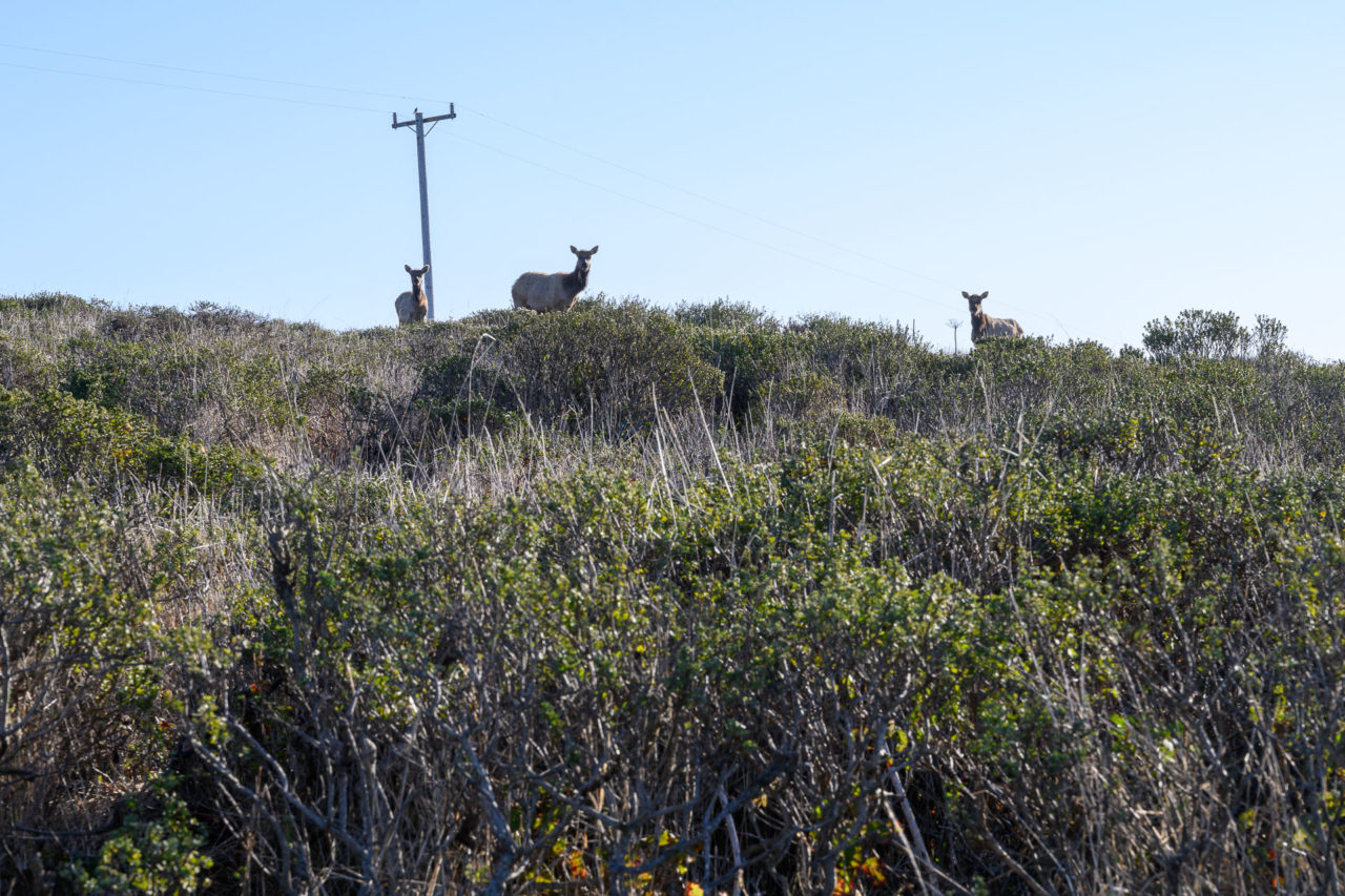
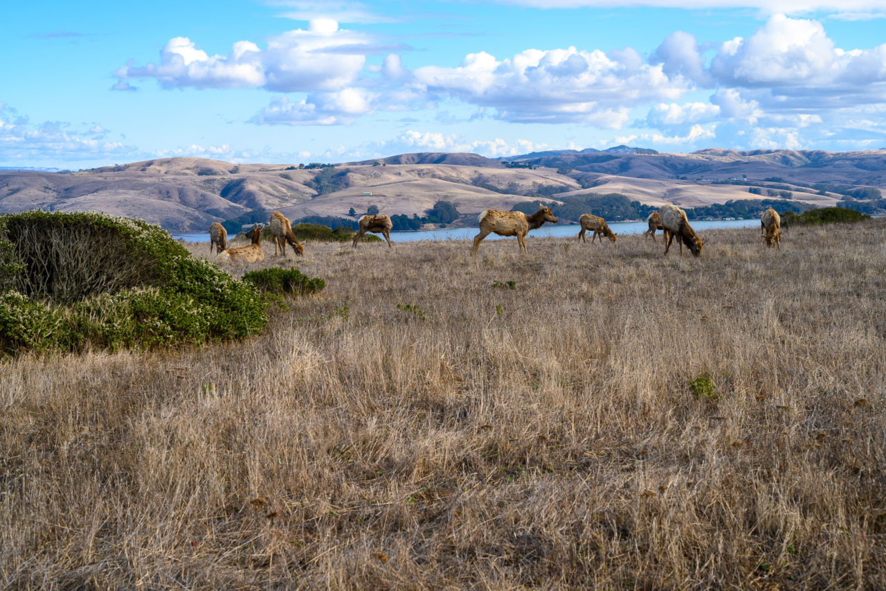
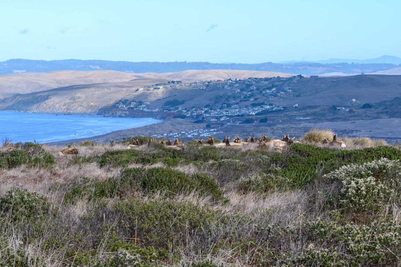
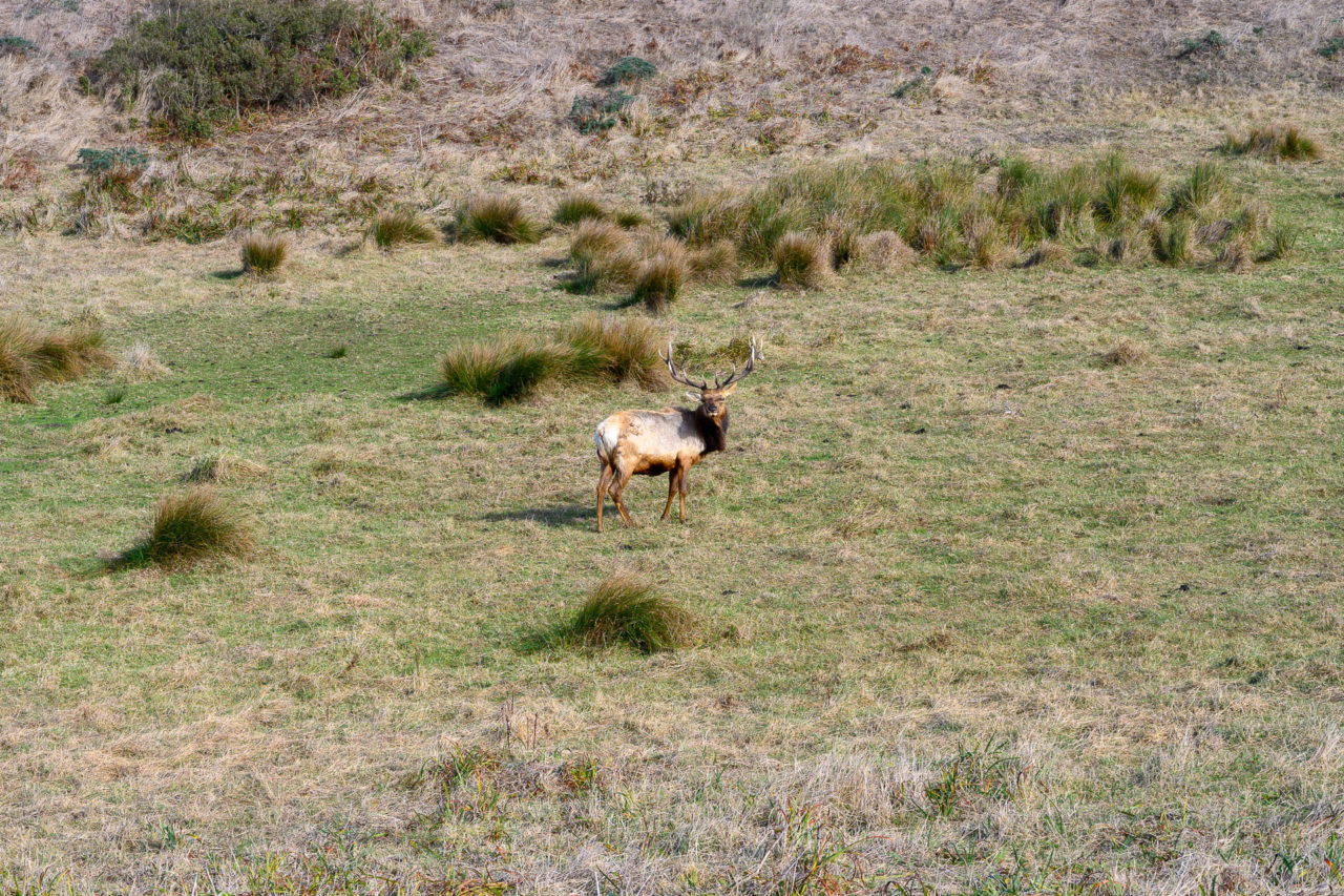
Tomales Bay Benchmark was a short hike from the main road. We spotted a herd of Tule Elk near the summit, the first of many we would see that day. As I would find out from trail signs later in the day, the Tule Elk had been wiped out of the area during the 1860’s. In 1978 ten elk were reintroduced to Point Reyes. Their population has since grown to over 400. We returned to the car then drove the remaining distance to the Tomales Point Trailhead at the end of Pierce Point Road.
9.7 Miles, 1350 Gain
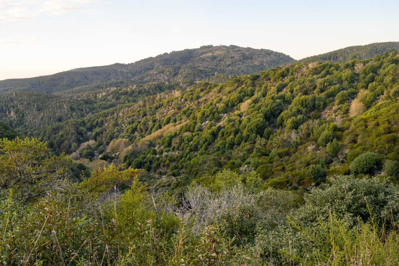
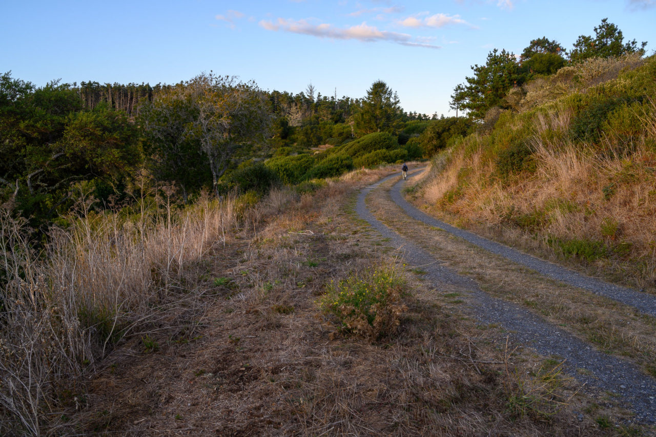
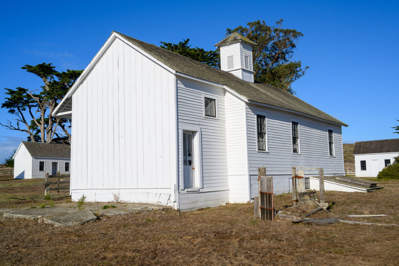
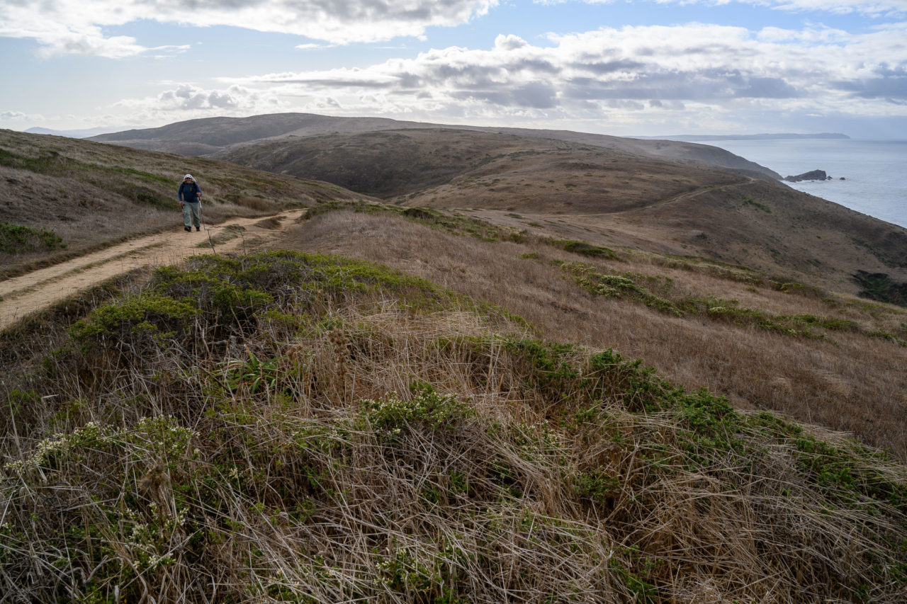
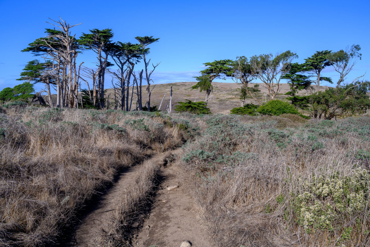
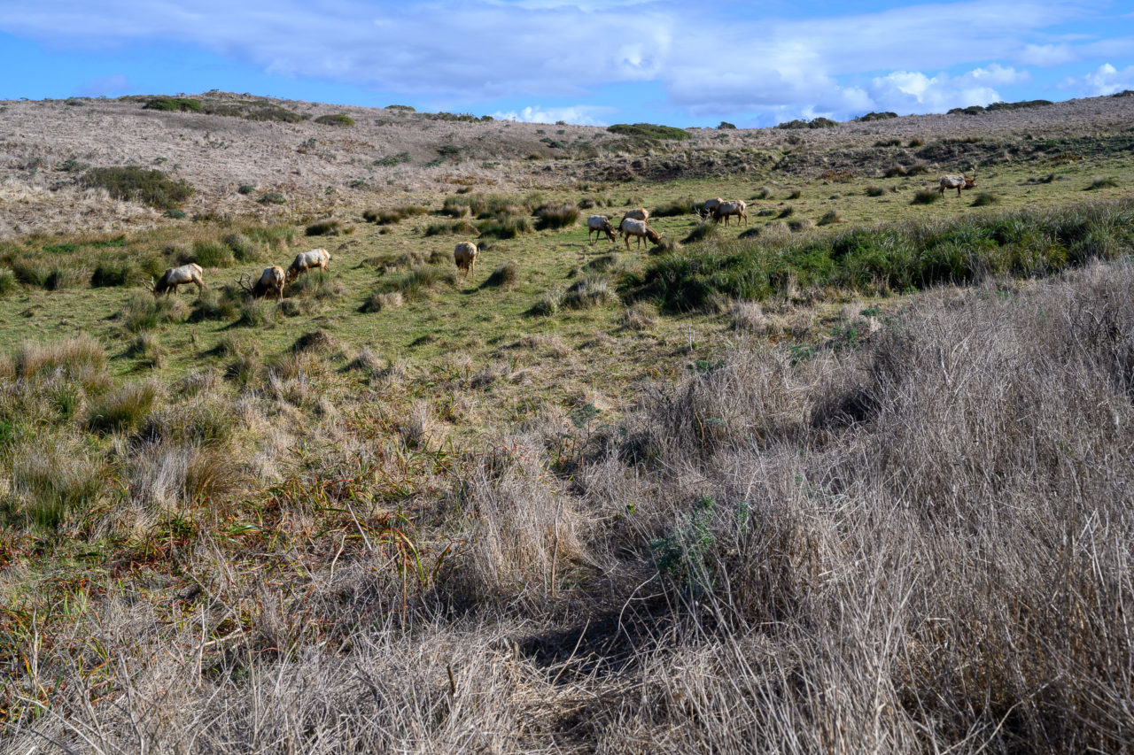
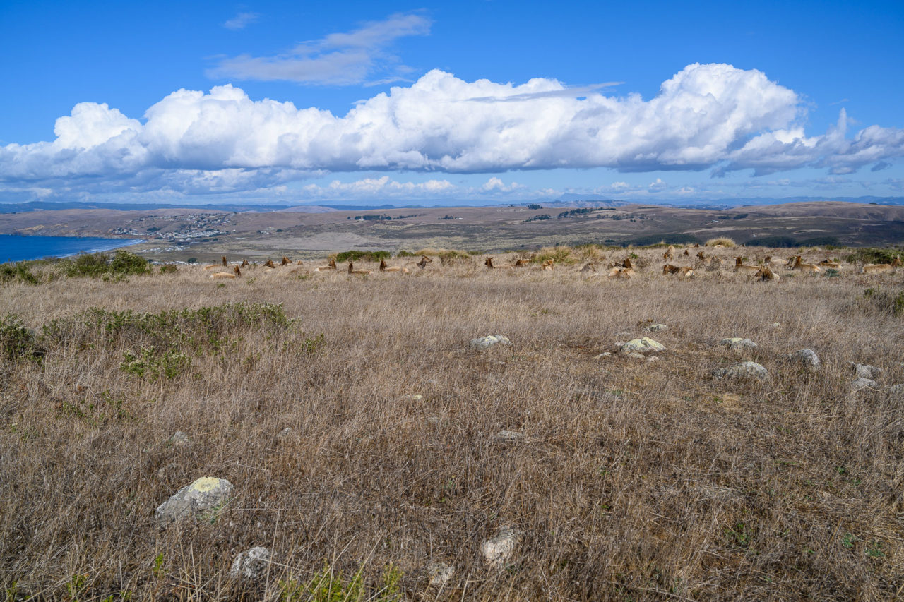
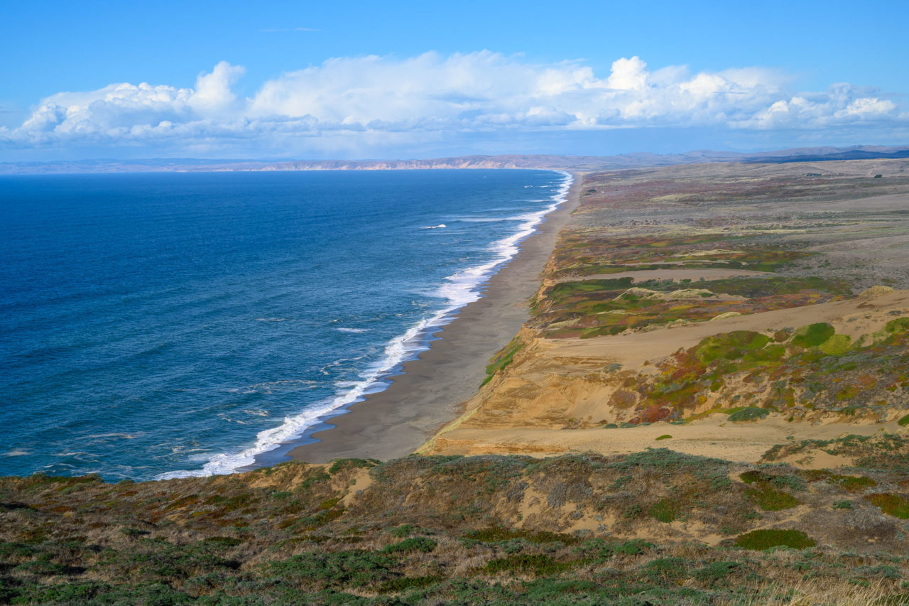
Despite getting there relatively early in the morning, the parking lot was already full. We took one of the last remaining spots, then spent some time walking through the nearby Pierce Point Ranch. Established in 1858, the ranch operated for over a century, and was recognized as one of the best dairy farms in the state. The trail leading to Tomales Point started from the parking lot, gradually making its way over rolling hills towards the northern tip of Point Reyes. We stopped briefly at Peak 545 then continued out to Tomales Point. Along the way, we photographed several large herds of Tule Elk. The trail went within 20ft of the herd, but they didn’t seem to mind the crowds passing by.
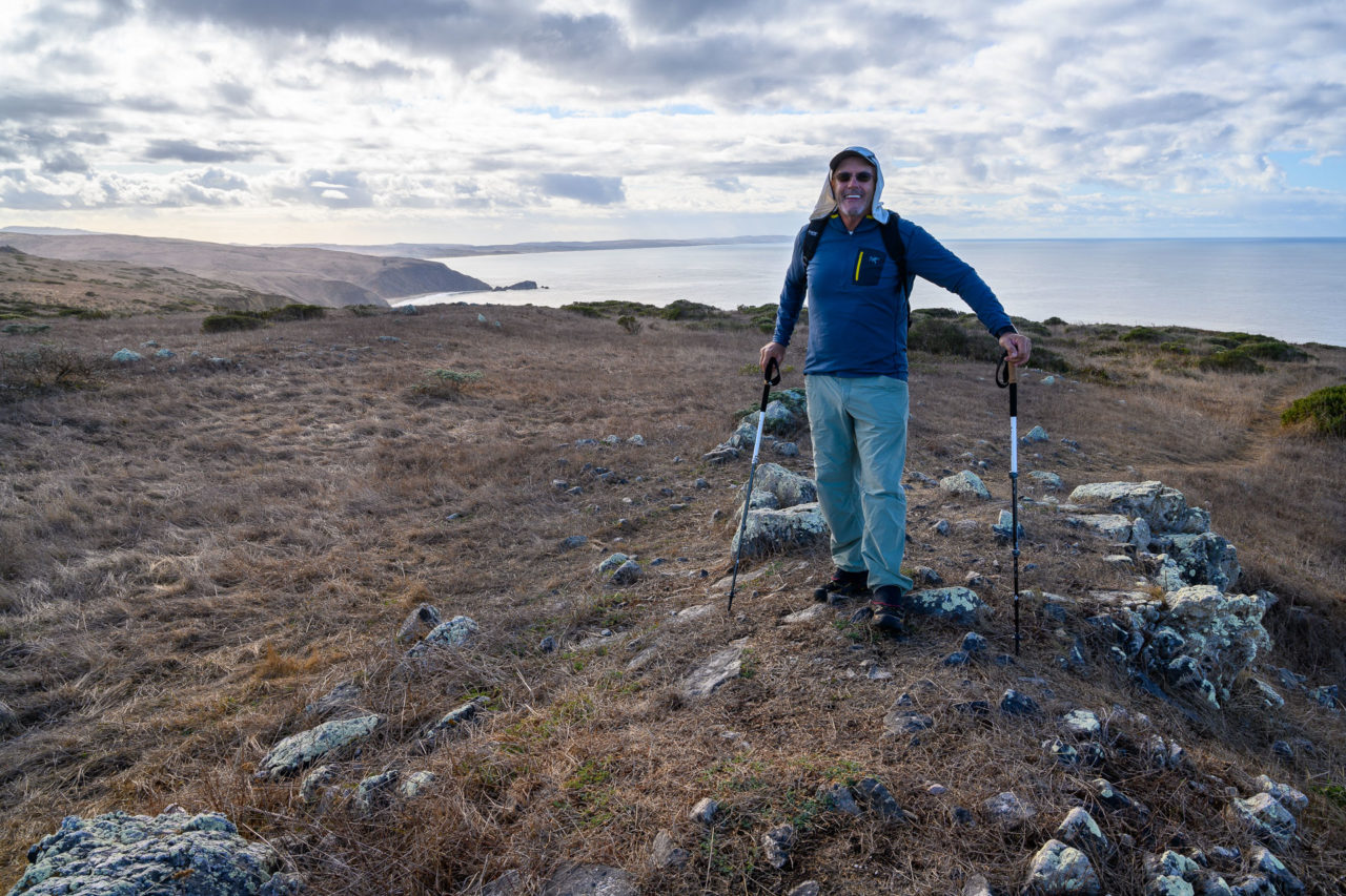
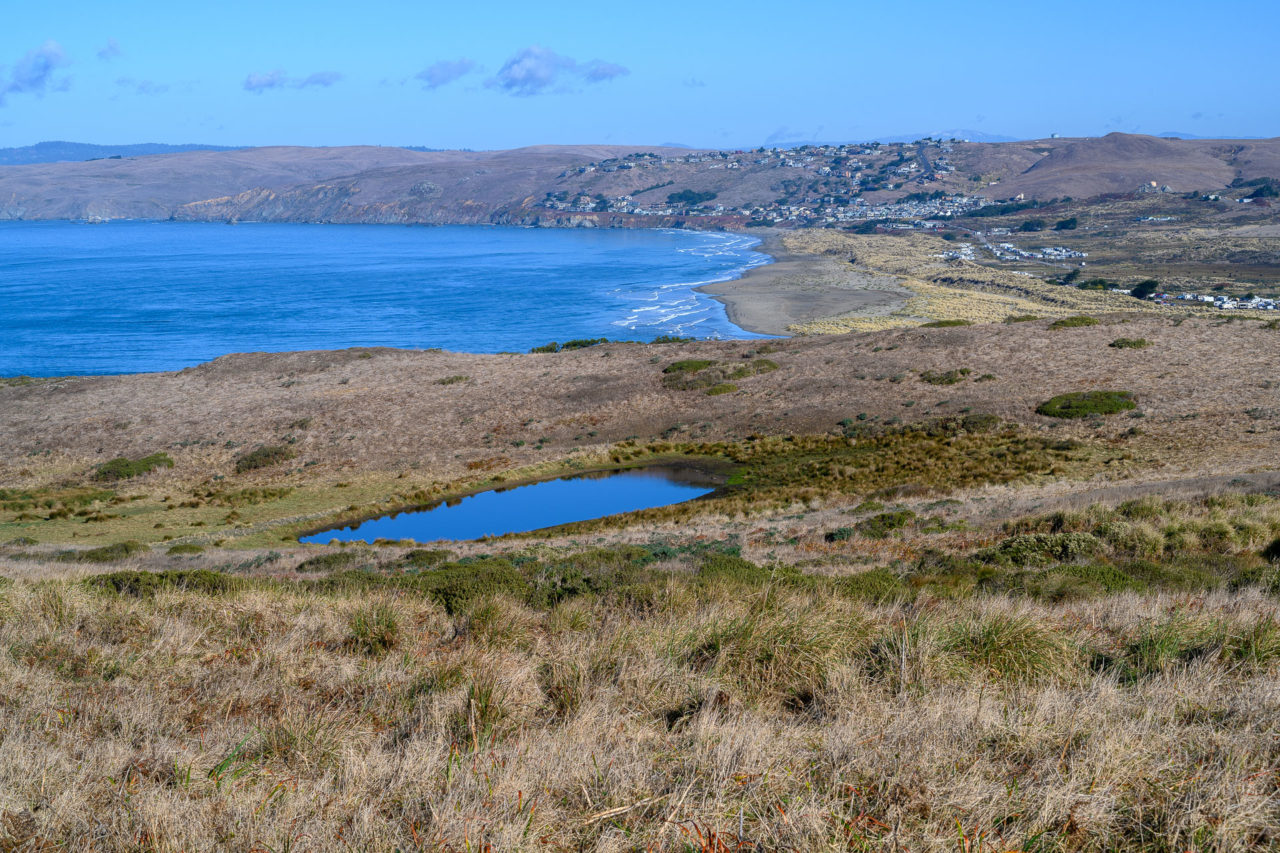
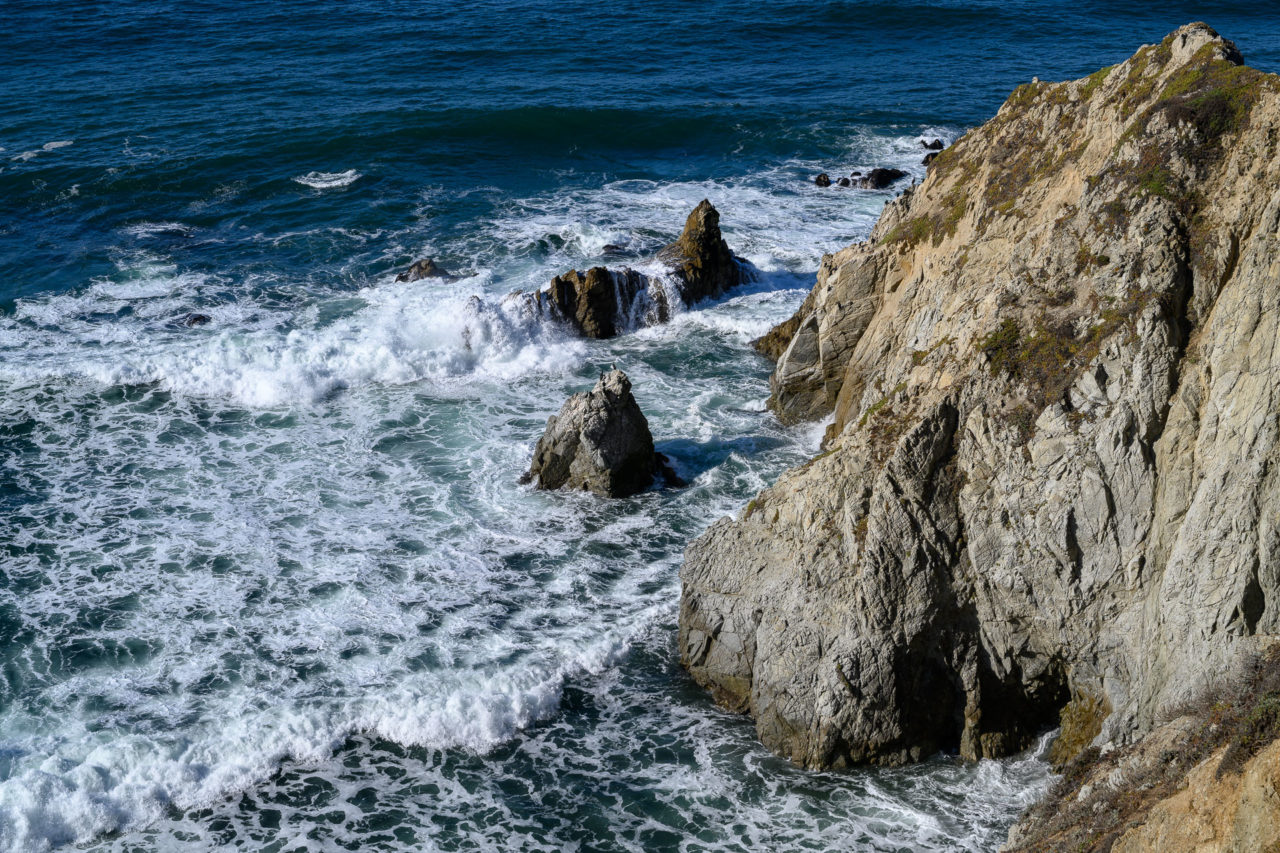
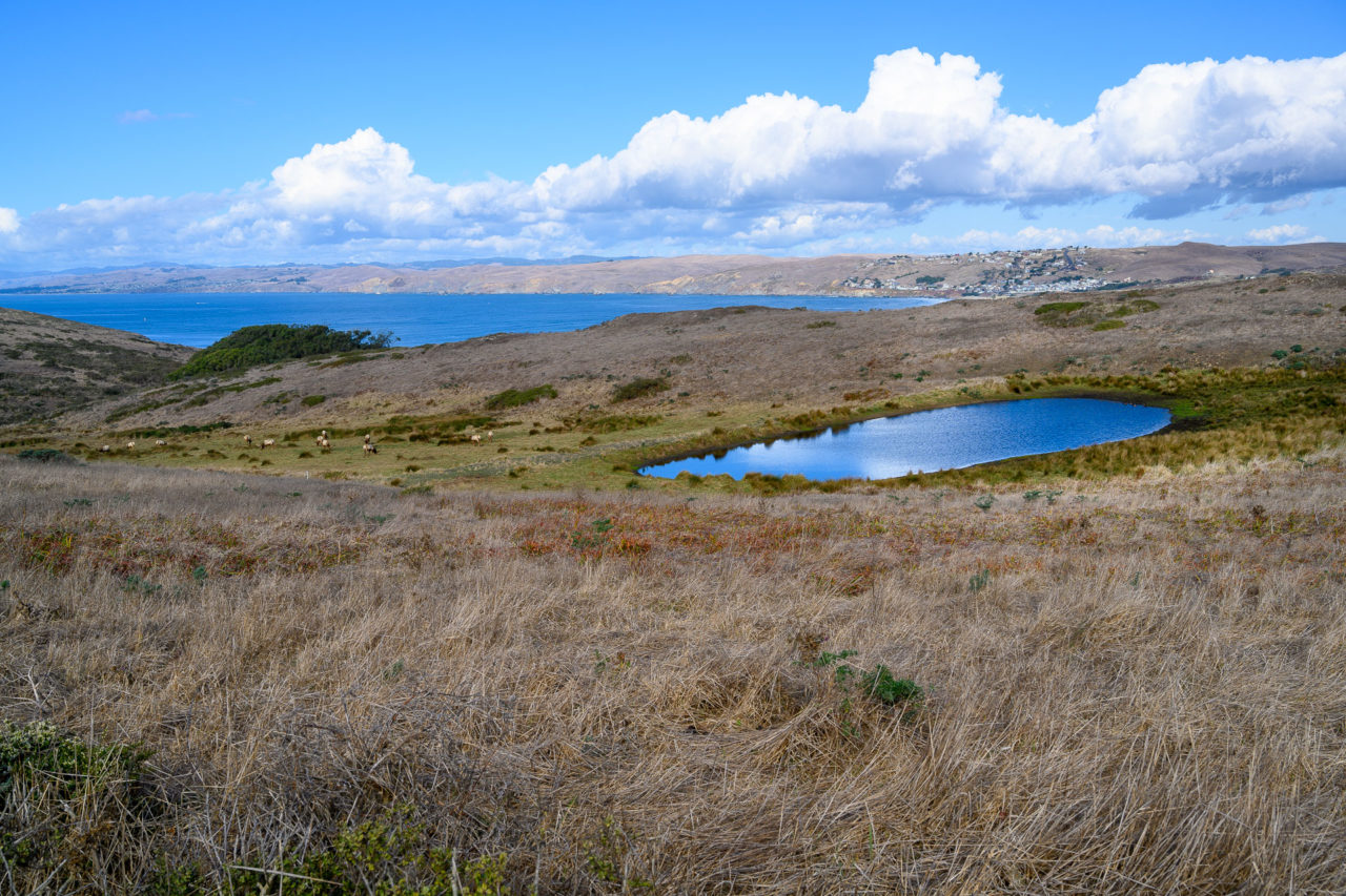
There were a few groups already at Tomales Point when we arrived, one of them flying a drone around the point. We took a snack break at the point before starting back to the car. On the return hike we passed well over a hundred people making their way out to Tomales Point, a far more popular hike then I had expected. The overflow parking lot was completely full when we got back to the car, with additional cars lining the road going up the hillside. Our next stop was Point Reyes, the highpoint above the lighthouse, which we were expecting to be even more crowded.

1.5 Miles, 500 Gain
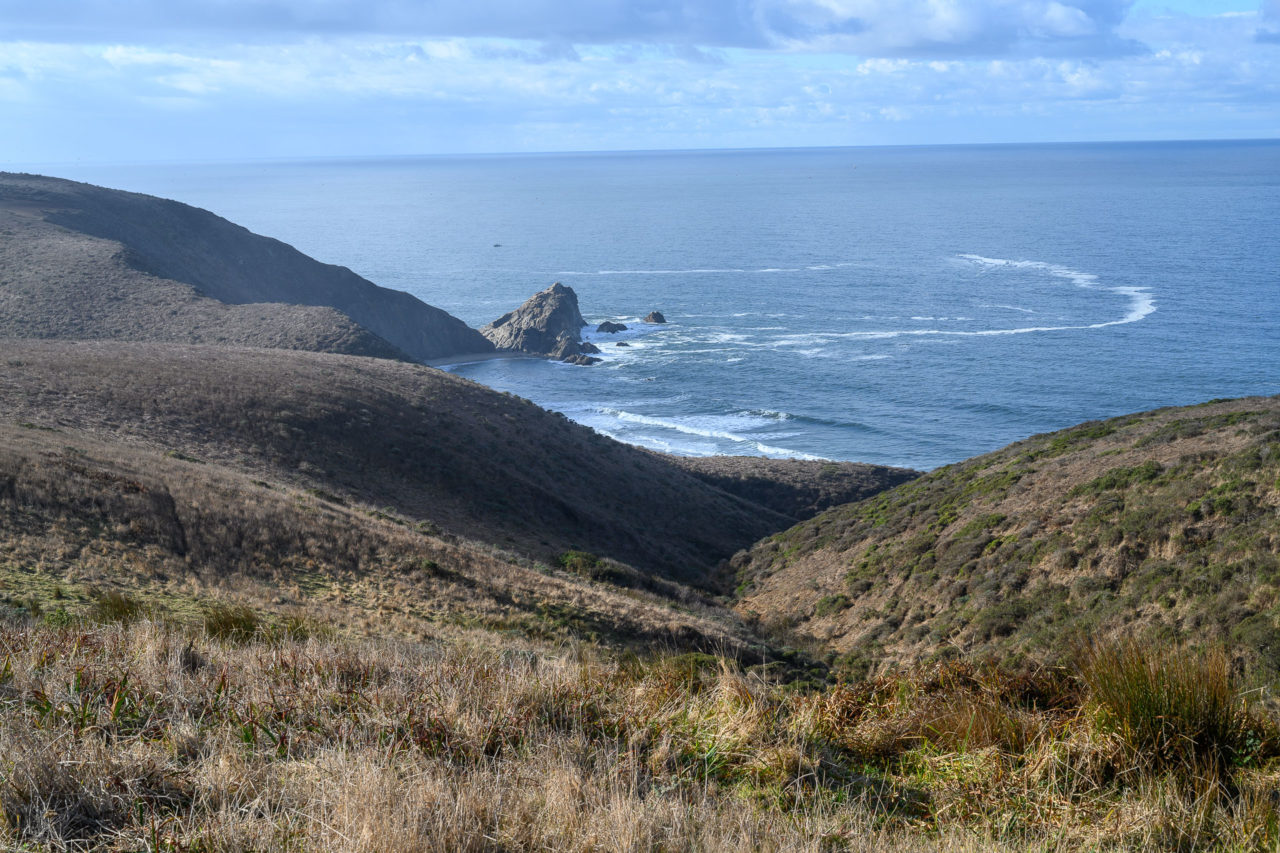
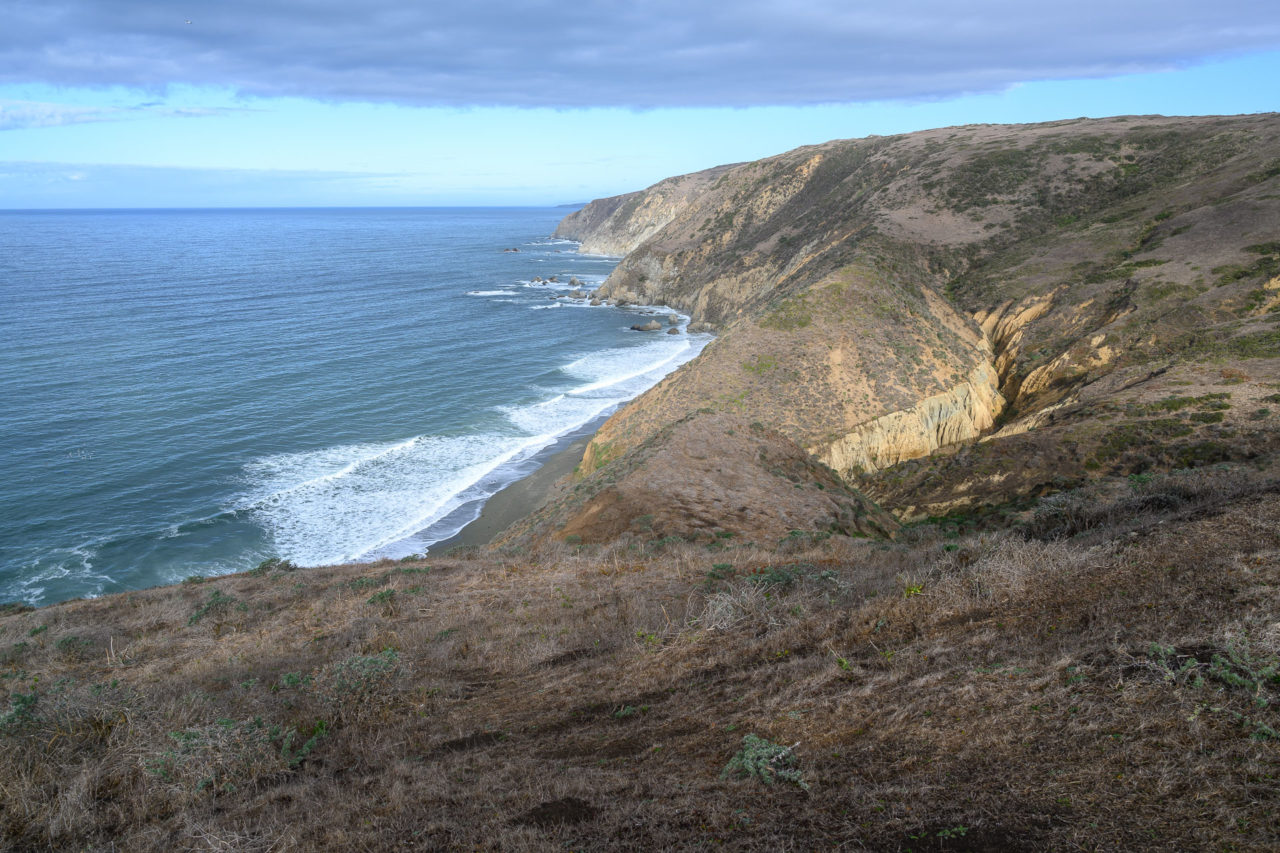
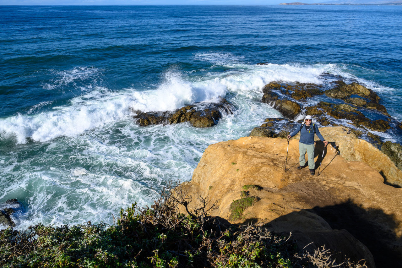
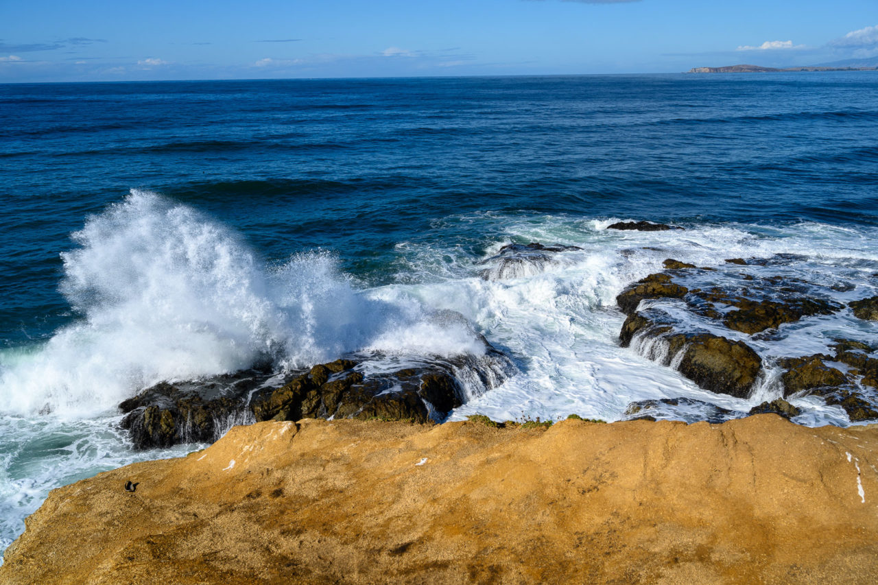
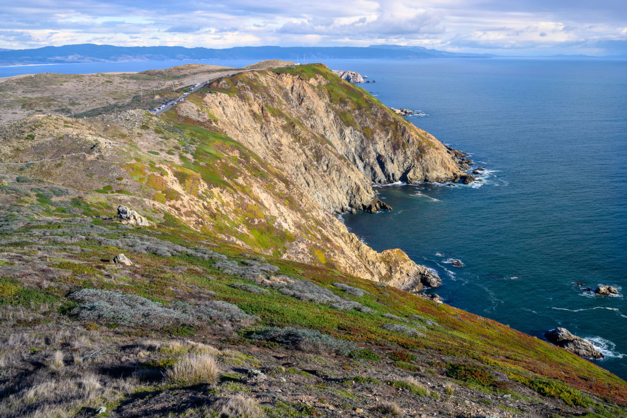
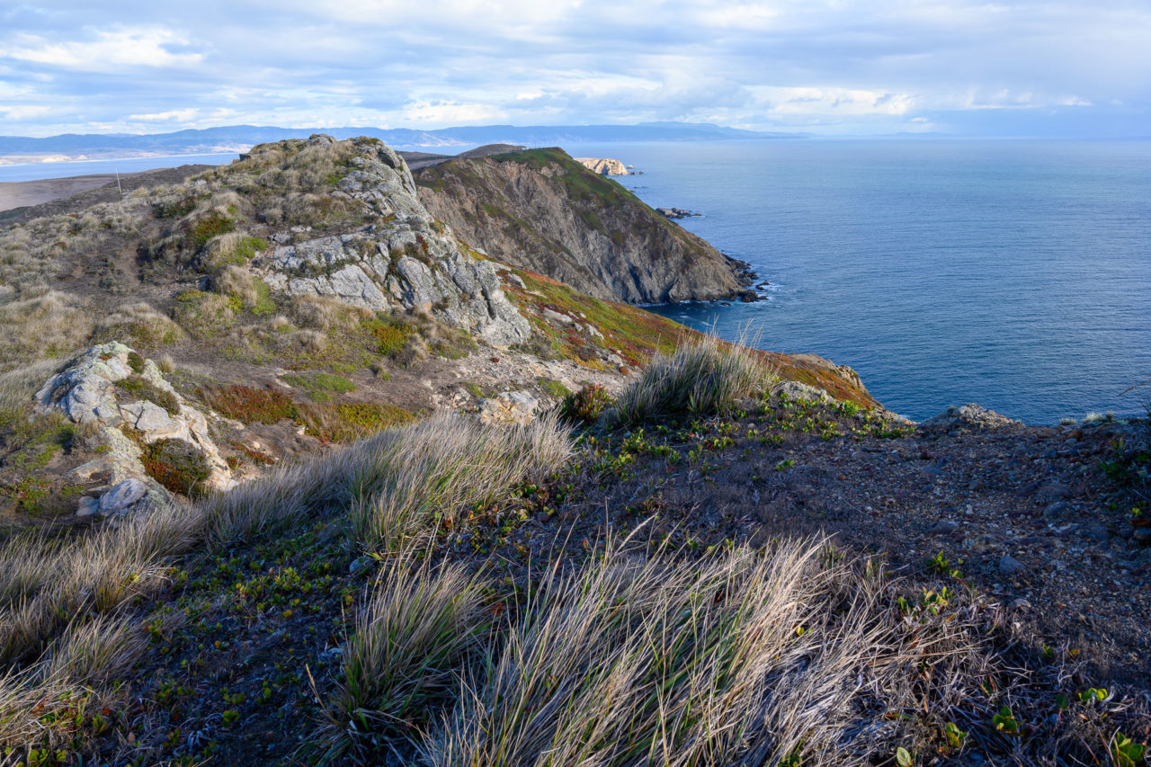
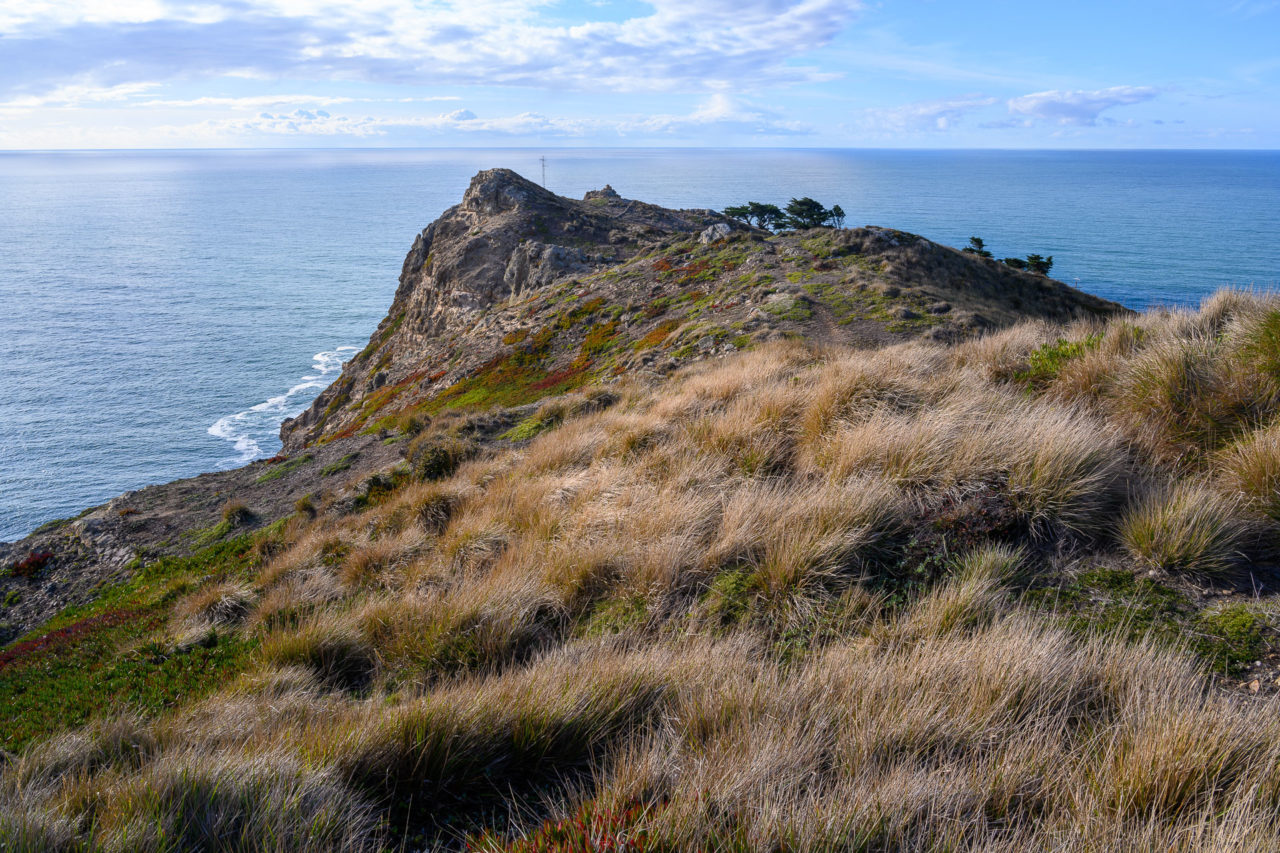
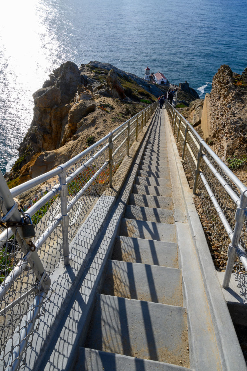
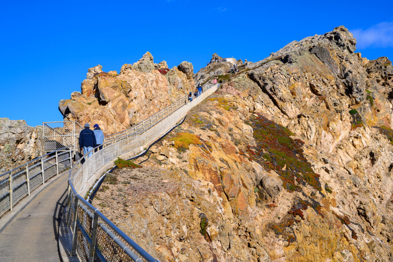
A line of cars greeted us as we queued up to find a parking spot near Point Reyes. Near the front, we were fortunate enough to find a car leaving, giving us a relatively good parking spot. A short hike up the hillside led to the highpoint of Point Reyes. There were nice views from the summit, and I was a bit surprised that no one else had made their way up there. A use trail continued along the ridge, rejoining the road near the lighthouse. A trip to Point Reyes without visiting the lighthouse wouldn’t be complete, so we lined up to make our way steeply down the 300 stairs leading out to the lighthouse. After listening to the park ranger talk about the history of the lighthouse, we started back up the stairs. Even with a few rest platforms along the way, it took quite a while as people would stop to catch their breath in the middle of the stairs. Back at the car, we started driving towards Mount Vision, a hike that I expected would be far less crowded then the others we had been on that day.

7.2 Miles, 1600 Gain
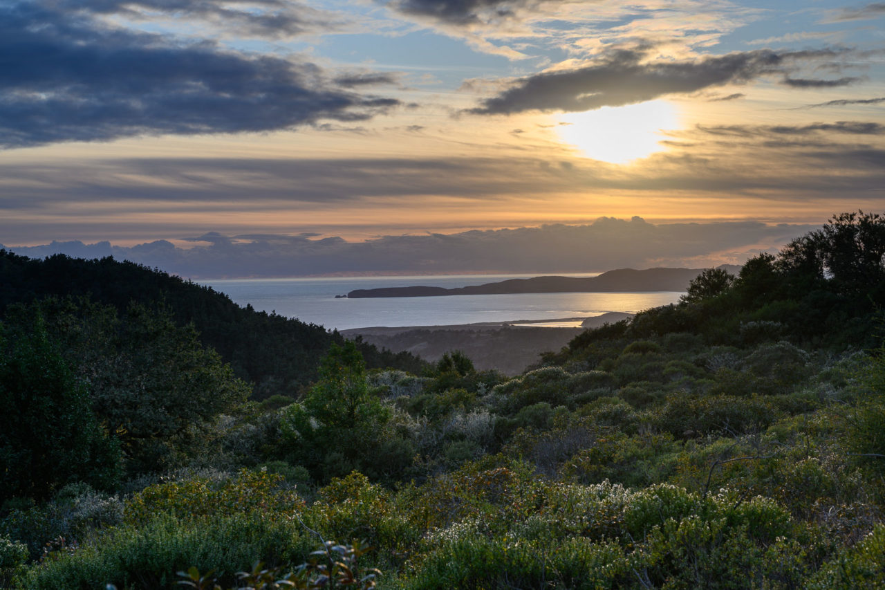
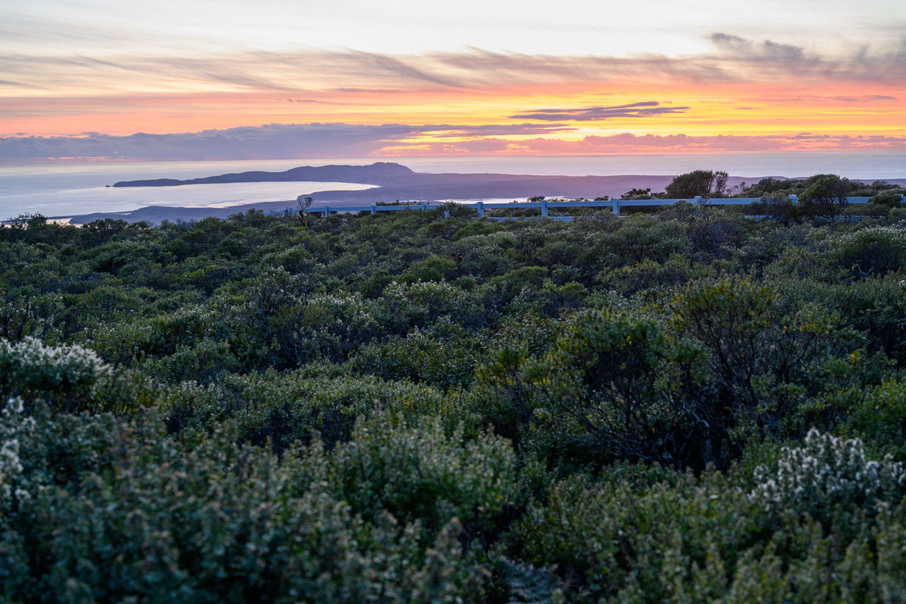
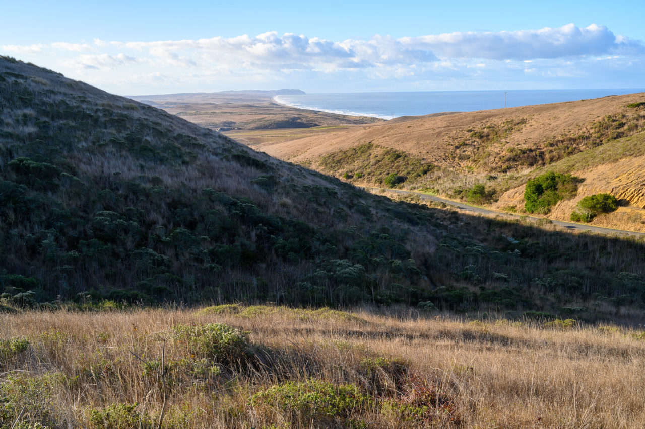
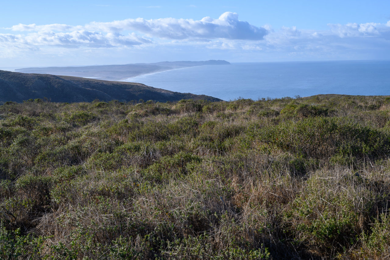
Normally it is possible to take Mount Vision Road nearly to the summit of Mount Vision. Point Reyes Hill is also nearby, making for a relatively easy hike to two peaks overlooking Point Reyes. Unfortunately for us, storm damage earlier that year had caused Mount Vision Road to close at the turnoff from Sir Francis Drake Blvd, making for a long road hike to the summit. A quick study of the park map showed an alternate route coming in from the south using the Inverness Ridge Trail. That route would be longer than I had originally planned (roughly seven miles round trip), but with some headlamp time we figured we could make it to the summit without too much trouble.
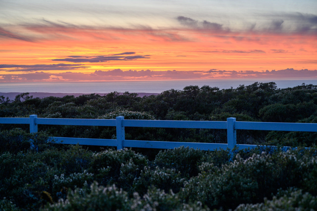
We drove back through the town of Inverness, then up Limantour Road to the Bayview Trailhead, starting north on the Inverness Ridge Trail around 4PM. The sun was already starting to get low in the sky, and we were hoping we could make it to Point Reyes Hill in time to enjoy the sunset. We followed the trail for several miles, first on a fire road then on single track, getting to FAA radar site atop Point Reyes Hill just as it was starting to get dark. We took a few pictures of the sun setting over Drakes Bay and Point Reyes, then put on headlamps before starting towards Mount Vision. A trail leads nearly to the summit of Mount Vision, requiring a short bushwhack to get to the true highpoint. We followed the same route on the way back, spotting a fox and a coyote on the trail before eventually returning to the car around 7PM.